TESTING: Maps

That’s an interesting experiment, one where both Mojeek and OpenStreetMap would benefit. I’d be glad to help in testing this feature. However, when I tried it, I got a blank page:

Has the experiment already ended?

You need JavaScript enabled for mojeek.com

But I didn’t block JavaScript… though it seems to be WebGL instead:

Transferring it to another browser profile with WebGL allowed resolved the problem.

Btw do you have any idea why WebGL is necessary for the map to function? This is the first time I’ve encountered a site that requires it.

If you right-click and drag, you will be presented with a 3D rendering of nearby buildings: London for example.

Oh so WebGL is necessary for 3D rendering? Thanks for the info!

But when I try to right-click and drag on a laptop’s trackpad, it would just zoom in or out. Are there other ways to trigger that 3D rendering?

It looks like you can use Ctrl.

2 Likes

Whoops, didn’t notice that. Thanks! Though I think it would be helpful to let users know that feature while inside the map, either having some buttons or scroll bar for tilting, or a menu of keyboard shortcuts that can pop up on hover or click.

2 Likes

After a bit of testing, here are my initial thoughts:

Design. I love the navigability of the map, where the features are clear enough to chart my own path. This is essential for commuters on places where Google Maps haven’t covered the public transportation. In contrast, Google Maps is extremely cluttered, filled with too many icons, and names of streets and establishments wouldn’t appear unless zoomed very closely.

Though there are still some room for improvement. First, I suggest using a different color for buildings to create larger color contrast to the roads. Second, add layers for public transport, at least trains or subways, similar to what Organic Maps has implemented. Both would improve navigability even further.

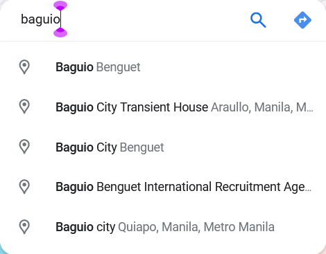
Information. Although the map can search for the location, it needs to have a dropdown box that list possible hits as there are often a lot of establishments and streets with the same names, or with multiple possible names. Like for example, in Google Maps:

image

I find this necessary for filtering the results, as it’s very rare to have an exact address of a location down to the last detail. This could also resolve one of @videonas’s concerns, where typing in “Nokia” will show a list of locations with that name, and he could then select which one fits his search.

Also, I think this is still too barebones, a map should at least have a way to click on the streets and establishments, and access the rich info provided by the volunteers on those elements. You could also add reviews from 3rd-party sites, essentially picking up where Google failed.

Navigation. This is, as of now, nonexistent. As @mike has stated, an ability to choose the starting point, the destination, and the preferred mode of transportation would be necessary for navigation to work. But it might be too much work in-house, perhaps a partnership with one of the apps using OSM would be more feasible? Where they would provide the routing algorithm, while Mojeek Maps would advertise them, as good routing will encourage more people to download and pay for their app.

Overall, at this phase, I see no use case. Though I would be looking forward for developments and be willing to test those.

3 Likes

Thanks a lot for all of these @snatchlightning, as it’s an early version of Maps that we’ve put here to get feedback, it’s very useful to get such detailed and prescriptive stuff.

We’ll be taking this and all other feedback into account when doing further changes. If you have anything else which you get through using it then please don’t hesitate to add it in :pray:

1 Like

After I enabled the summary in my browser, I haven’t touched on maps for a while. I just wanted to re-enable it, but it’s not working for me any more. I’ve tried removing all cookies for Mojeek and adding the FFID eiSoh7iiback in, but maps isn’t showing up where it was working before.

Did something change?

This still should work, I’m getting the tab pop up with the cookie. Which domain are you setting the cookie on - .com?

Ok, I was able to fix it with the help of another computer. The bug could be traced back to my own stupidity :face_with_peeking_eye:

1 Like

Just wanted to say I am really liking maps so far, and even motivated me to contribute to OSM!

One small UI bug I found is that upon clicking the align north, the icon doesn’t also point to the north.

1 Like

That’s great to hear @NOCanoa; on the north alignment, do you mean that this:

image

would be better as:

Screenshot from 2024-05-21 09-22-32_2

Yeah, because when you click it, the map gets aligned but the icon still pointing right. @Josh

1 Like

I think that permanently readjusting the icon to point North would be pretty simple; something that moved with the user’s alignment on the map might be a bit finnicky - would that change be more clear for yourself?

ccing @AshboDev here for something a bit more concrete

1 Like

is it because icon in its normal state it pointing right, cloud just a 45º offset fix it?

1 Like

Apologies I got my wires crossed in the original message, shouldn’t be too hard to fix as you’ve said so that the compass is pinned to North to begin with! :pray:

2 Likes

btw is the map manually updated?, and how often?

1 Like

For the moment, in the testing phase, it has not been updated, and we have some bits from this which need to be switched up off the back of user feedback (thanks to all).

Once live it should be updated every week, automatically pulling any fresh data from OpenStreetMap.

1 Like